![](/images/other/stat-length.png)
![Tour Wandern La Motte-en-Champsaur - Jas de Jartier - Photo](https://media.geolcdn.com/t/1900/400/f77a6a7c-6e5d-40aa-9152-87e370bb16b8.jpg&format=pjpeg&maxdim=2)
Jas de Jartier
Marco05
Benutzer GUIDE
![Länge](/images/other/stat-length.png)
![Maximale Höhe](https://static1.geolcdn.com/siteimages/upload/files/1508320355ic_sort_altitude_max_24dp.png)
![Positive Höhendifferenz](https://static1.geolcdn.com/siteimages/upload/files/1508320355ic_sort_den_pos_24dp.png)
![Km-Effort](/images/other/stat-length.png)
![Min. Höhe](https://static1.geolcdn.com/siteimages/upload/files/1508320355ic_sort_altitude_min_24dp.png)
![Negative Höhendifferenz](https://static1.geolcdn.com/siteimages/upload/files/1508320355ic_sort_den_neg_24dp.png)
![Boucle](https://static1.geolcdn.com/siteimages/upload/files/16400158638029165_repeat_loop_refresh_sync_direction_icon.png)
![Wandern](https://static1.geolcdn.com/sitytour/trail-icons/101.png)
5h22
Schwierigkeit : Schwierig
![Scannen Sie diesen QR-Code, um die Tour in der SityTrail-Anwendung zu öffnen](https://capi.geolives.com/qq0zvz2zws4bq2lad0pu/sitytour/trails/3735085/qr.png?size=200)
Kostenlosegpshiking-Anwendung
Über SityTrail
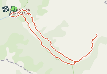
Tour Wandern von 13,7 km verfügbar auf Provence-Alpes-Côte d'Azur, Hochalpen, La Motte-en-Champsaur. Diese Tour wird von Marco05 vorgeschlagen.
Beschreibung
Randonnée au départ de Molines en Champsaur.
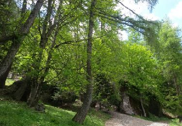
Traverser le village pour prendre le chemine qui domine la piste de retour.
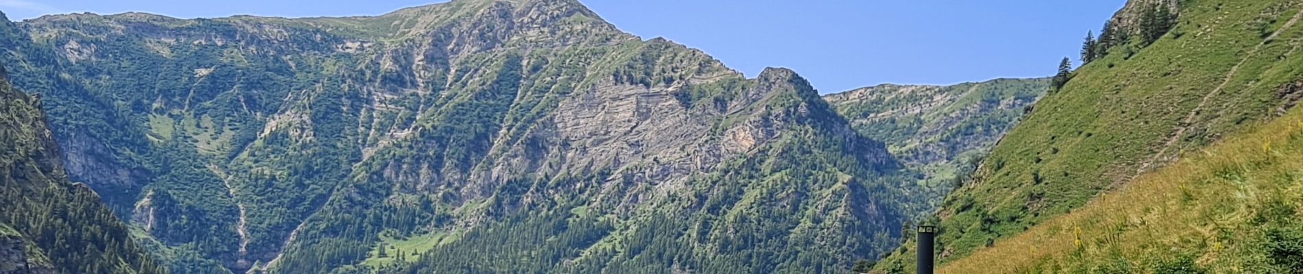
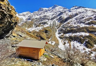
Quelques passages exposés, mais en passant avec précaution il n'y a aucun risque.
Le final monte un peu raide, surtout après la sortie de la forêt.
A la descente, passer les ruines de Sellon, puis prendre le chemin à gauche 500m plus loin.
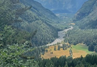
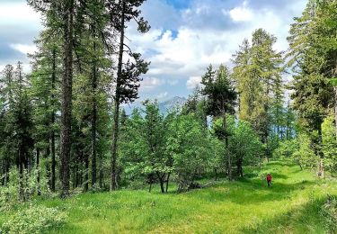
Après la descente sur le torrent, suivre la piste jusqu'au village.
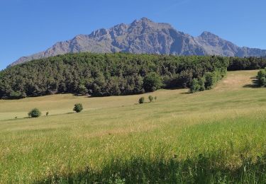
Cette randonnée reste très physique.
Ort
Kommentare
Touren in der Umgebung
![Tour Wandern Saint-Bonnet-en-Champsaur - Les infournas - Lac des Barbeyroux 22/09/23 - Photo](https://media.geolcdn.com/t/375/260/0538c280-feb5-4d65-96e8-19b0b69c47f0.jpg&format=jpg&maxdim=2)
![Wandern Wandern](https://static1.geolcdn.com/sitytour/trail-icons/101.png)
Wandern
![](/images/other/stat-length.png)
![](https://static1.geolcdn.com/siteimages/upload/files/16400158638029165_repeat_loop_refresh_sync_direction_icon.png)
![Tour Wandern Saint-Bonnet-en-Champsaur - Col de l'Escalier - Photo](https://media.geolcdn.com/t/375/260/380e390b-b1b8-4ba8-8042-65c036c6fc44.jpg&format=jpg&maxdim=2)
![Wandern Wandern](https://static1.geolcdn.com/sitytour/trail-icons/101.png)
Wandern
![](/images/other/stat-length.png)
![](https://static1.geolcdn.com/siteimages/upload/files/16400158638029165_repeat_loop_refresh_sync_direction_icon.png)
![Tour Wandern Saint-Jacques-en-Valgodemard - 20190409_Lac de Roaffan - Photo](https://media.geolcdn.com/t/375/260/9022de43-54f4-44a8-9678-8541607672ee.jpg&format=jpg&maxdim=2)
![Wandern Wandern](https://static1.geolcdn.com/sitytour/trail-icons/101.png)
Wandern
![](/images/other/stat-length.png)
![](https://static1.geolcdn.com/siteimages/upload/files/16400158638029165_repeat_loop_refresh_sync_direction_icon.png)
![Tour Wandern La Motte-en-Champsaur - 01-06-14 Chemin de Ronde de Molines - Photo](https://media.geolcdn.com/t/375/260/ext.jpg?maxdim=2&url=https%3A%2F%2Fservices.sitytrail.com%2FGeolivesWS%2FDownloadMedia.ashx%3FTrailID%3D308305%26Media%3Dfix__20140601142415.jpg)
![Wandern Wandern](https://static1.geolcdn.com/sitytour/trail-icons/101.png)
Wandern
![](/images/other/stat-length.png)
![](https://static1.geolcdn.com/siteimages/upload/files/16400158638029165_repeat_loop_refresh_sync_direction_icon.png)
![Tour Wandern La Motte-en-Champsaur - 2023 Molines en champsaur - Photo](https://media.geolcdn.com/t/375/260/8cec2c36-77a4-44ec-9429-880c71e3680f.jpg&format=jpg&maxdim=2)
![Wandern Wandern](https://static1.geolcdn.com/sitytour/trail-icons/101.png)
Wandern
![](/images/other/stat-length.png)
![](https://static1.geolcdn.com/siteimages/upload/files/16400158638029165_repeat_loop_refresh_sync_direction_icon.png)
![Tour Wandern La Motte-en-Champsaur - La Motte le Col de la Blache - Photo](https://media.geolcdn.com/t/375/260/b61f57f6-a4e9-410d-9b38-3ccb5733b4a6.jpg&format=jpg&maxdim=2)
![Wandern Wandern](https://static1.geolcdn.com/sitytour/trail-icons/101.png)
Wandern
![](/images/other/stat-length.png)
![](https://static1.geolcdn.com/siteimages/upload/files/16400158638029165_repeat_loop_refresh_sync_direction_icon.png)
![Tour Wandern La Motte-en-Champsaur - jas de jartier - Photo](https://media.geolcdn.com/t/375/260/3c33cb52-561b-40aa-8cdd-d79fd690218e.jpg&format=jpg&maxdim=2)
![Wandern Wandern](https://static1.geolcdn.com/sitytour/trail-icons/101.png)
Wandern
![](/images/other/stat-length.png)
![](https://static1.geolcdn.com/siteimages/upload/files/16400158638029165_repeat_loop_refresh_sync_direction_icon.png)
![Tour Wandern La Motte-en-Champsaur - Jas de Jartier - Photo](https://media.geolcdn.com/t/375/260/51d99883-619f-4da2-9c23-416dc15ef668.jpg&format=jpg&maxdim=2)
![Wandern Wandern](https://static1.geolcdn.com/sitytour/trail-icons/101.png)
Wandern
![](/images/other/stat-length.png)
![](https://static1.geolcdn.com/siteimages/upload/files/16400158638029165_repeat_loop_refresh_sync_direction_icon.png)
![Tour Wandern Saint-Bonnet-en-Champsaur - Crête Le Barry Via Les Infournas Hauts - Photo](https://media.geolcdn.com/t/375/260/50caa5eb-5ef8-4dd0-8900-2d0329add72f.jpg&format=jpg&maxdim=2)
![Wandern Wandern](https://static1.geolcdn.com/sitytour/trail-icons/101.png)
Wandern
![](/images/other/stat-length.png)
![](https://static1.geolcdn.com/siteimages/upload/files/16400158638029165_repeat_loop_refresh_sync_direction_icon.png)